
Fuya Fuya Map
(Click on the GPS points to see the photos; use two fingers to move the map)
Routes
routes
| Route | Difficulty | Time |
|---|---|---|
| Otavalo Route: | Easy | |
| Laguna Grande – Summit 1 | Easy | 1h45min |
| Summit 1 – Highest Summit | Easy | 30min |
| Atahualpa Route: | Easy | |
| Atahualpa – Road End | 1h | |
| Road End – Summit 1 | 4h30 |
- Recommendations
Recommendations
- To make this ascent, it is convenient to approach from Otavalo to Laguna Grande de Mojanda.
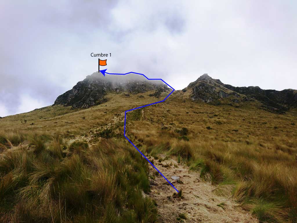
- The trail to the Fuya Fuya summit begins at the head of the Laguna Grande, just barely reaching the lagoon.
- The climb to the Fuya Fuya summit 1 is very easy, basically trekking in paramo.
- The majority of people only arrive until the summit 1; very badly done!
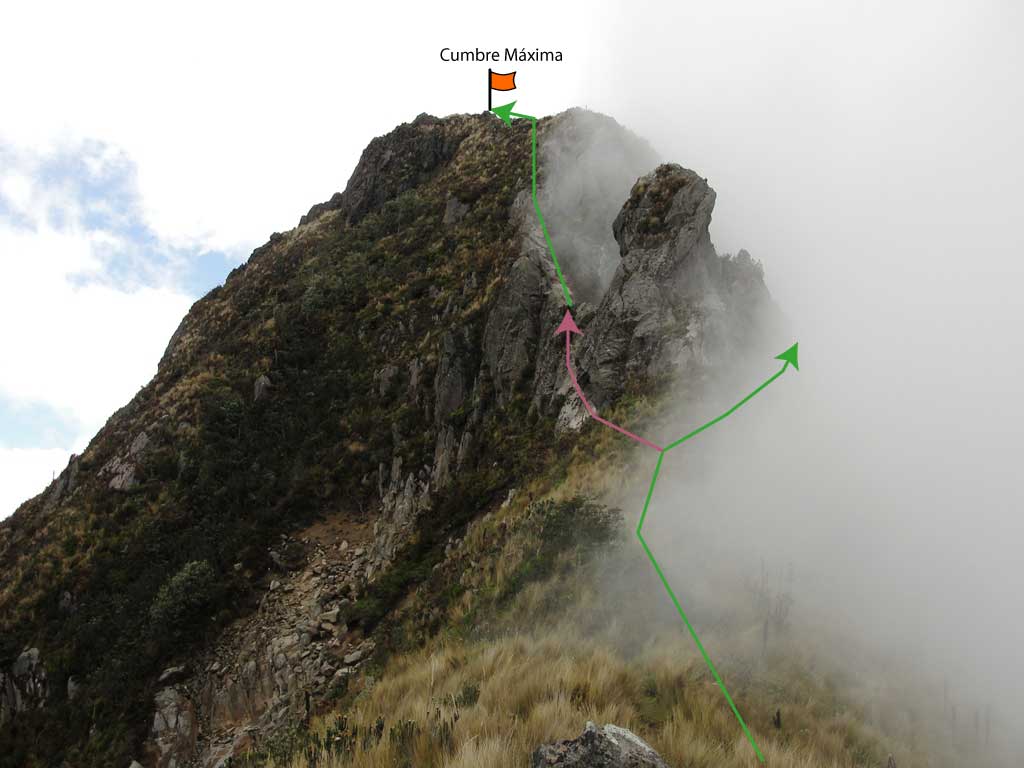
- The walk from the summit 1 to the highest summit demands a little more difficulty.
- When you reach the base of the highest summit rock, you can choose to take to the right or left of the "tooth".
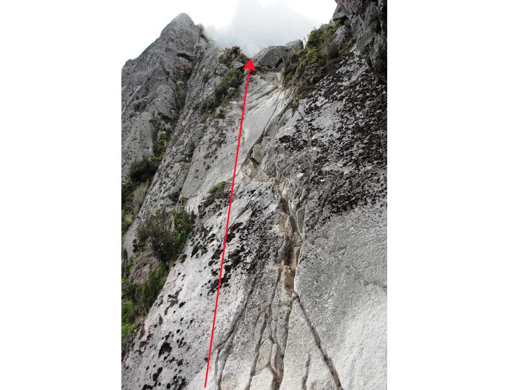
- On the right, the tooth is circumvented and then a short gutter is taken that ends in a III degree climb about two meters of solid rock, the rest way to the summit is practically walking.
- On the left, the tooth is bypassed and a rock plate of about 70 degrees is reached with a very fun but short climb through a crack of solid rock grade IV, the climb is about six meters high and is somewhat exposed, then just walk to the summit.
- Both summits are covered with paramo and diverse vegetation.
- The view is very nice when you have the luck of a good weather, usually this mountain has a cap of perennial clouds on its peaks, and the most you will see are white shadows running at high speed.
- The approach from Atahualpa ends on the same side of the mountain ; the best will be to simply continue on the same route as indicated towards the summit.
- If you have private transportation, or rent a pickup truck in Atahualpa, it is possible to save the first hour of walking on the cobblestone - ballasting.
