
Pasochoa Map
(Click on the GPS points to see the photos; use two fingers to move the map)
Routes
routes
| Route | Difficulty | Time (up) |
|---|---|---|
| Hydroelectric Route: | ||
| Hydroelec. – Summit 2 | Easy | 3 - 4h |
| Alternative to Summit 2 | Easy | 30 - 45min |
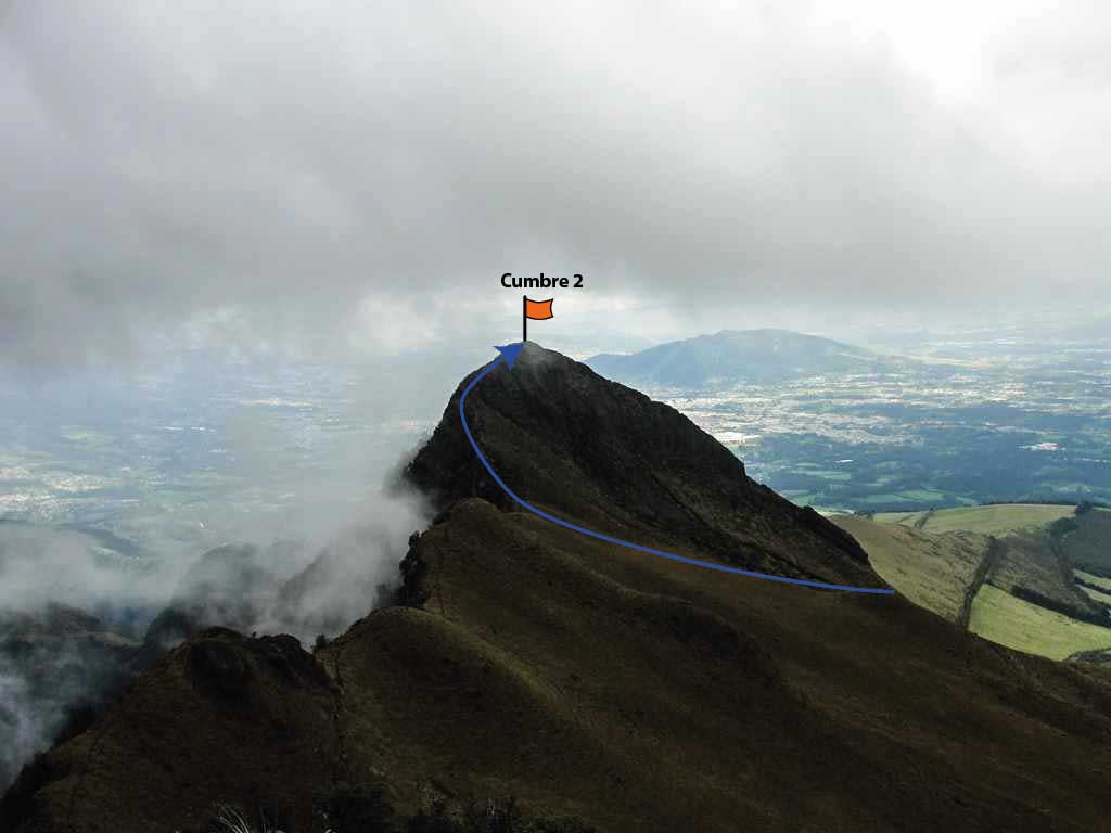
| Summit 2 – Highest Summit | Easy | 1h |
| Hydroelec. – Summit 2 – Hydroelec. | Easy | 4 - 5h |
| Refugio de Vida Silvestre Pasochoa Route: | ||
| Refugio de Vida Silvestre Pasochoa – Summit 1 | Easy | 4 - 5h |
| Refugio de Vida – Summit 1 – Refugio de Vida | Easy | 6 – 8h |
- Recommendations
Recommendations
- Hydroelectric Normal Route, you can get to the Hydroelectric by cobblestone road on almost any vehicle, and advance until the metal gate where the hike to the summit begins. This door is about a hundred meters beyond the hydroelectric water reservoir. There is very limited parking space; therefore, vehicles should be parked in any nearby place without obstructing the road. One suggestion would be to park next to the water reservoir entrance door.
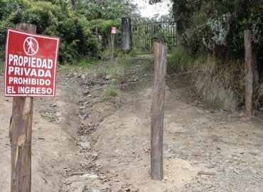
- Note: The Hydroelectric Route to the Pasochoa summit passes through private land. Now, they have put up warning signs and a barbed wire fence to prevent entry. It is necessary to pay US 1.00 per person to be able to pass.
- The hike from the metal gate to the Summit 2 can take between 3 and 4 hours.
- The first section is very simple, just following up the path that was once a car road.
- This road ends at an abandoned house, from there take the trail that continues up through the paddock on the right side.
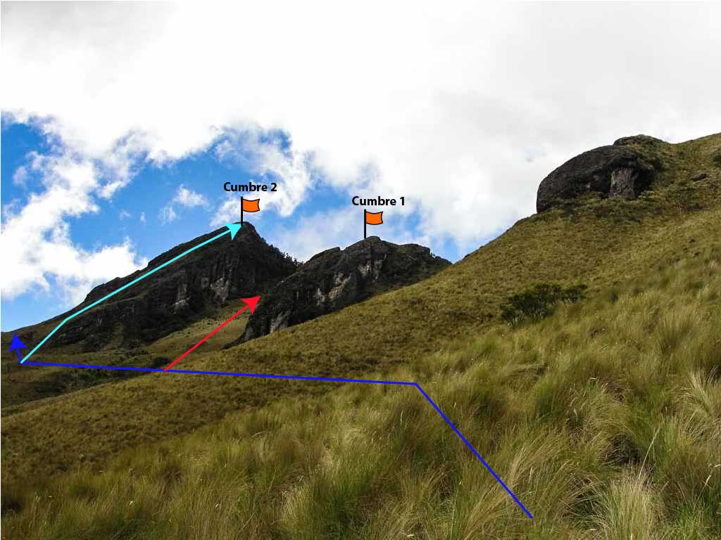
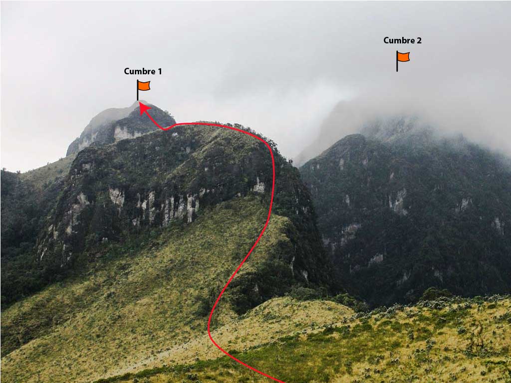
- The ascent is in paramo until almost the summit; you pass at the foot of summit 1 and to continue to summit 2, there you may choose between two options: the Alternative (direct route) or the route through the back of Summit 1, the latter being the easier. Both routes are recommended for beginners.
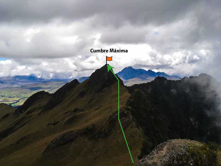
- The Pasochoa Highest Summit requires an additional hour of hiking with an easy climbing near the summit.
- The Summit 1 route from the Refugio de Vida Silvestre Pasochoa is longer but more picturesque ; It can take between 4 and 5 hours to reach the Summit 1, and from there one more hour until the Summit 2.
- If you choose the Refugio de Vida route, you have to climb a little to reach the Summit 1. The climb is a III to IV degree, normally it doesn't represent major difficulties if you have the experience and it's dry. The problem is when it rains the descent gets risky. Many times what can be climbed cannot be lowered down.
- You can have the unique luck, especially in winter, that you receive a downpour present with ears break hail, it is precisely in these circumstances that you can enjoy another spectacular attraction of the Pasochoa: the slide.
- Enjoy this mountain very much and take many photos; but beware of deciding to take many steps backwards in the direction of the caldera (recommendation applicable to any summit).
