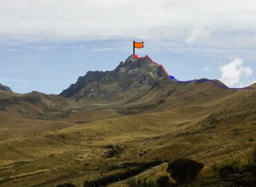
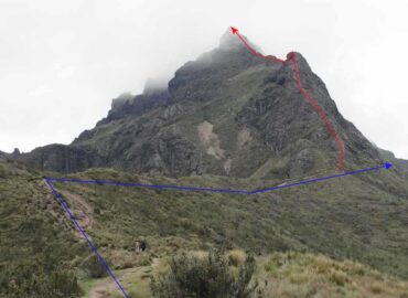
Ruco Pichincha Map
(Click on the GPS points to see the photos; use two fingers to move the map)
Get Directions
Routes
routes
| Route | Difficulty | Time |
|---|---|---|
| From the cable car upper station (round trip): | ||
| Normal Route "Arenal" | Easy | 4 - 6h |
| Ridge Route (Agujas) | A little difficult (PD) | 5 - 7h |
| Espolon Orellana Route | Fairly difficult (AD) | 6 - 8h |
- Recommendations
Recommendations
- One day is usually required to climb the summit of this mountain starting from Quito.
- If you are going to climb to the Ruco Pichincha summit, it is convenient to register your ascent at the Low Station of the Teleferico.
- The Teleferico stops working at 8:00 pm; taking into account that the descent takes 18 minutes, the maximum time to embark back is 7:30 pm. It is recommended to pay attention to the schedules of the Teleferico for the ascent date; these schedules may change depending on the time of year. As a general rule, the hours are extended a bit on holidays and in the summer.
- You can check the Teleferico schedules on this page: Teleferiqo Quito
- The path to the Ruco Pichincha summit is very well marked; You can usually reach the summit without complications. However, there have been people and groups that have gone astray, which means that no mountains can be underestimated, especially when it is cloudy or if you do not have the experience or the necessary equipment.
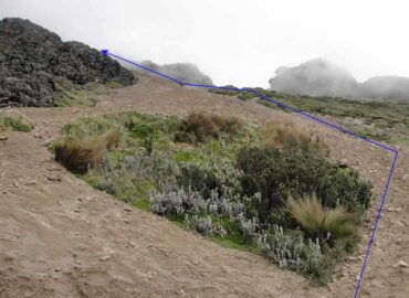
- The "Arenal" route It is mostly a hike, very easy to follow the path until the sand is finished. The last part there are small rock sections with III degree climbing, this section has little signage.
- Avoid the Ruco Pichincha summit or climbing the ridge if rain is suspected. There have been people killed by lightning storms on this mountain. Recommendation applicable to any other mountain.
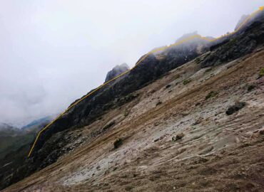
- The rock ridge route It is recommended to people who have some rock climbing experience.
- Most of the ridge climbing takes place on good rock of a III degree difficulty.
- There are exposed areas in which a fall is not allowed.
- The most difficult section is known as "Paso de la Muerte". At this step, you must go down the rock edge, cross on a narrow rock wall, and then climb again with a IV degree difficulty. The rock is good but a fall could be fatal; that is why the use of a rope is recommended for the people who require it.
- After the "Paso de la Muerte", you reach the foot of the Ruco Pichincha summit, only an easy walk through the sand.
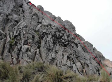
- The "Espolon Orellana" route It is little frequented. Climbing knowledge is required to be able to ensure a hundred meters and exit to a sector near the "Paso de la Muerte". This route has steps from III to V grade in rock, it is recommended to take some safety equipment, taking into account that there are sections up to V grade, which can be wet and with moss. Some cintas, nuts and friends can be useful. The rock is mostly good; but there is no fixed line to climb it and each group goes up where it is best for them; You will probably find some bad rock, extreme caution is advised, as many people walk along the normal route at the base of this spur and a fall of rocks could be dangerous.

