
Altar Volcano
Description
El Altar is a beautiful Ecuadorian volcano located in the eastern mountain range between the Chimborazo and Morona Santiago provinces. Its Quichua name is Capac Urco: “urco”, which means “hill”; and “capac”, which means “great”. The Altar Volcano is distinguished by having a large horseshoe shape opened towards the inter-Andean alley, its crater filled by the mysterious “Laguna Amarilla” lagoon, around which appear a series of singularly beautiful steep peaks, baptized with almost mystical names: Obispo, Monja Grande, Monja Chica, Tabernáculo, Fraile Oriental, Fraile Central, Fraile Beato, Fraile Grande and Canónigo. All these sublime peaks have exercised great fascination among Ecuadorian mountaineers, who have always felt an irresistible desire to overcome these steep glaciers and vertiginous rocks.
Data Table
| Place | Elevation |
|---|---|
| Bocatoma de Quimiag | 3435m |
| Hacienda Releche | 3060m |
| Laguna Amarilla | 4345m |
| Valle de Collanes | 3870m |
| Obispo | 5315m |
| Canónigo | 5260m |
| Monja Grande | 5260m |
| Penipe | 2470m |
| La Candelaria | 2950m |
| Riobamba | 2760m |
National Park
Photos
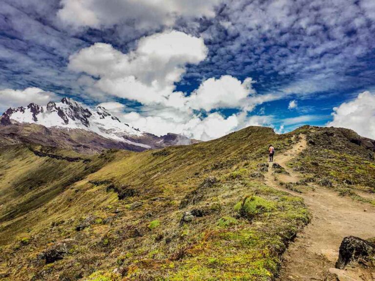
Trail to the Obispo
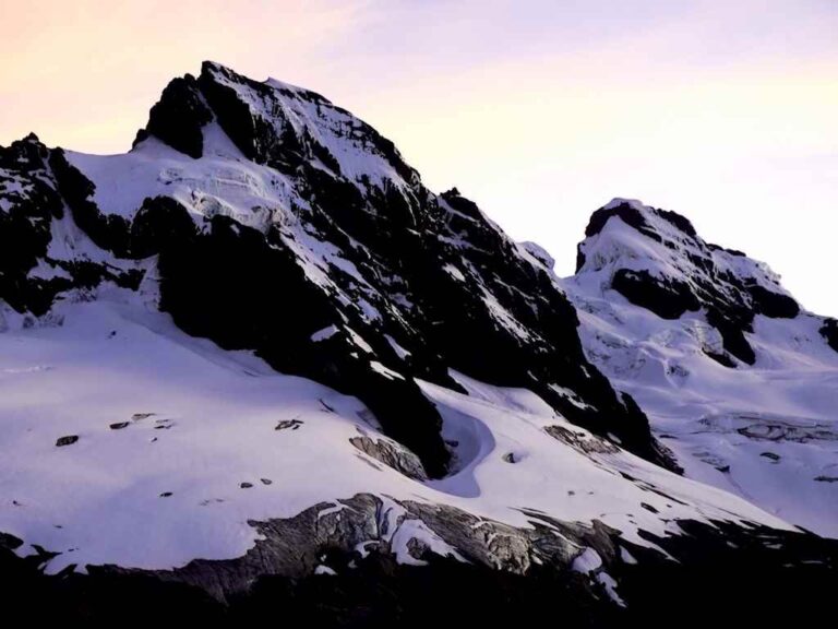
Obispo and Monja Grande
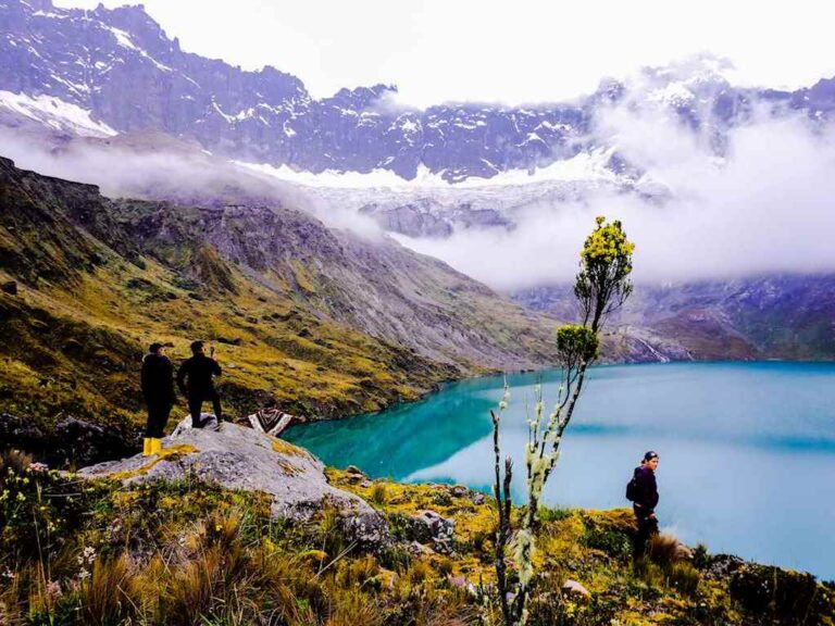
Laguna Amarilla
Photo Gallery
Climbing and Hiking
Starting from Hacienda Releche:
- Hacienda Releche - Valle de Collanes - Laguna Amarilla
- Canónigo Summit
- Fraile Grande Summit
Starting from Bocatoma de Quimiag:
- Bocatoma de Quimiag - Campo Italiano
- Campo Italiano - Collanes Valley
- Bocatoma de Quimiag - “Laguna Azul” lagoon (Negra Pagcha)
- Campo Italiano - Laguna Mandur - Laguna Escondida - Caldera Viewpoint
- Bocatoma de Quimiag - Laguna Estrellada
- Bocatoma de Quimiag - Laguna Pintada and Quindecocha
- Campo Italiano - Obispo Summit
- Campo Italiano - Monja Grande Summit
- Campo Italiano - Tabernáculo Summit
- Bocatoma de Quimiag - Cubillín Massif
Flora

Blechum sp.

Hesperomeles sp.

Fuchsia sp.

Gentianella rupicola
Flora Gallery
- How to get
- Distances
- Recommendations
- History
How to get
Eastern Mountain Range; 25.3 kilometers in a straight line east of Riobamba; 29km south of Baños de Agua Santa.
- Releche Route: This route is used to access the Collanes Valley and “Laguna Amarilla” lagoon, within the volcano's caldera. Likewise, it's used to climb the northern side peaks, such as Canónigo or Fraile Grande. Depart from Riobamba or Baños taking Highway 490 towards Penipe town. In Penipe, take the detour to La Candelaria community and Hacienda Releche, where you can park your vehicle to begin the hike.
- Bocatoma de Quimiag Route: This route is used by mountaineers who wish to access the peaks south of Altar, such as the Obispo summit or Monja Grande. To get to the Bocatoma of Quimiag, you can start from Riobamba in the direction of Cubijíes, Quimiag, and continue to the Bocatoma, where you park the vehicle to begin the hike towards the Italian Camp at the foot of Obispo.
