
Imbabura Volcano
Description
The Imbabura is the most representative mountain in the province of Imbabura, in Ecuador, much photographed for rising with a prominent cone from Lake San Pablo at 2670m to its maximum summit at 4640m, that is almost 2000 meters of agricultural land and paramos which end up on a steep gray rock. The Imbabura has a diameter of approximately 16km, around which are located very typical and picturesque cities and towns of the Ecuadorian highlands, such as Ibarra, Otavalo, Atuntaqui and San Pablo del Lago. The fertile valleys are also abundant, painted with all kinds of crops and some centennial haciendas now converted into inns, including Zuleta and Cusín.
Data Table
| Place | Elevation |
|---|---|
| Highest Summit | 4640m |
| Summit 1 | 4563m |
| Hiking Start | 3380m |
| San Pablo Lake | 2670m |
Photos
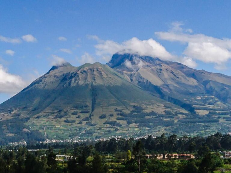
Imbabura Volcano
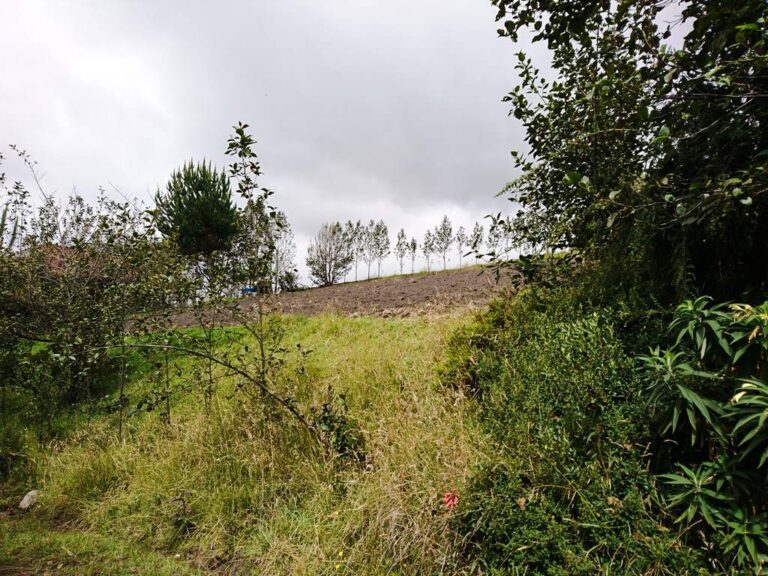
Fields on the volcano slopes
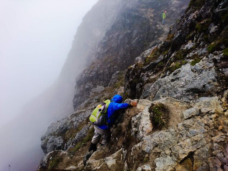
Near the Highest Summit
Photo Gallery
Climbing and Hiking
- Ascent to the Imbabura summit, La Esperanza route
- Ascent to the Imbabura summit, San Pablo del Lago route
- San Pablo Lake Loop Road (bicycle route)
- Cayambe - Olmedo - Zuleta - Ibarra (bicycle route)
- Cubilché lagoon hike
- Trekking to the Puruhanta Lagoon
- Click for more information
Flora
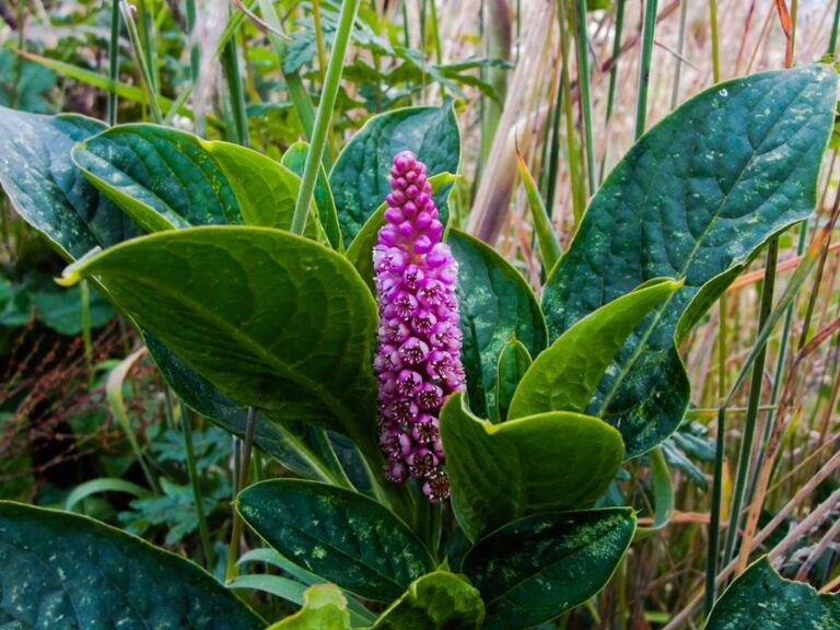
Phytolacca sp.
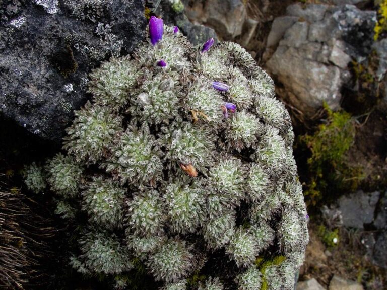
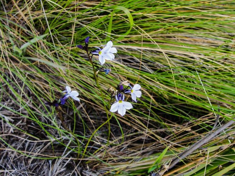
Lobelia tenera
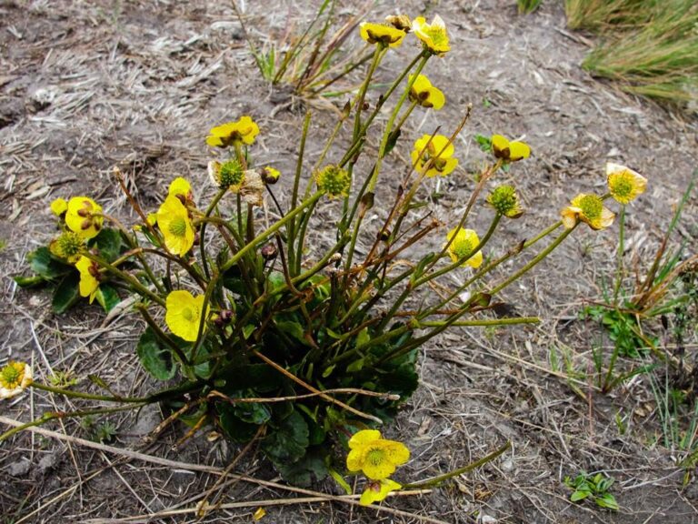
Flora Gallery
- How to get
- Distances
- Recommendations
- Volcanology
How to get
Nudo de Mojanda Cajas; 12 kilometers in a straight line southwest of Ibarra; 60 km in a straight line northeast of Quito. There are two routes of approach to the Imbabura Volcano:
- Normal Approach "Ibarra": In the city of Ibarra take the road that goes up to the town of La Esperanza. To get to this route it's necessary to enter the city, one possibility is to follow Avenida Teodoro Gómez de la Torre eastward and then Avenida El Retorno south until you reach the town of La Esperanza. Leaving the town towards Zuleta, you will see a small bridge; just before crossing it there is a cobbled road to the right that goes up an additional 5km towards the Imbabura.
- Approach "Zuleta": Take the highway from Cayambe to Otavalo. Approximately 2.5km to the north and you will find a road to the right that leads to the towns of Ayora, Olmedo and Zuleta. Take this road and eventually you will reach Zuleta and later La Esperanza. Just before entering the town, you cross a small bridge and you will find on the left a path that goes up to the Imbabura for an additional 5km.
- Alternative to the "Zuleta" approach: There is also the possibility of reaching the southern head of the San Pablo Lake, where there is a detour that leads to the town of San Pablo and later to Angochagua and La Esperanza.
