
Quilotoa Beltway Trail
Description
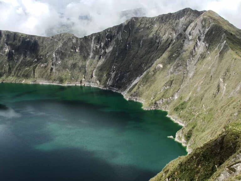
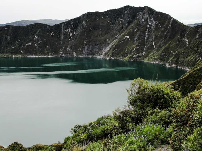
Quilotoa is a beautiful volcanic crater with a lagoon of green waters inside. The volcano, which is located in the Cotopaxi Province, has a crater approximately 3 kilometers in diameter and the lagoon is 375 meters below the crater viewpoint. The Circunvalación del Quilotoa trail starts at the South Crater Viewpoint, 12 kilometers from the town of Zumbahua. It's a somewhat demanding hike due to the number of ups and downs, and how steep some of them can be. However, the effort is worth it for the impressive views of the crater from all angles.
Data Table
| Place | Elevation |
|---|---|
| Monte Juyende | 3933m |
| South Crater Viewpoint | 3882m |
| Lagoon | 3508m |
| Zumbahua | 3515m |
| Sigchos | 2868m |
National Park
Photos
Steep ups and downs
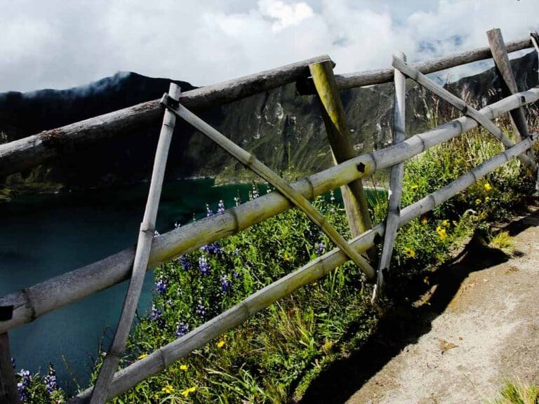
Beautiful landscapes
The crater of a volcano
Flora
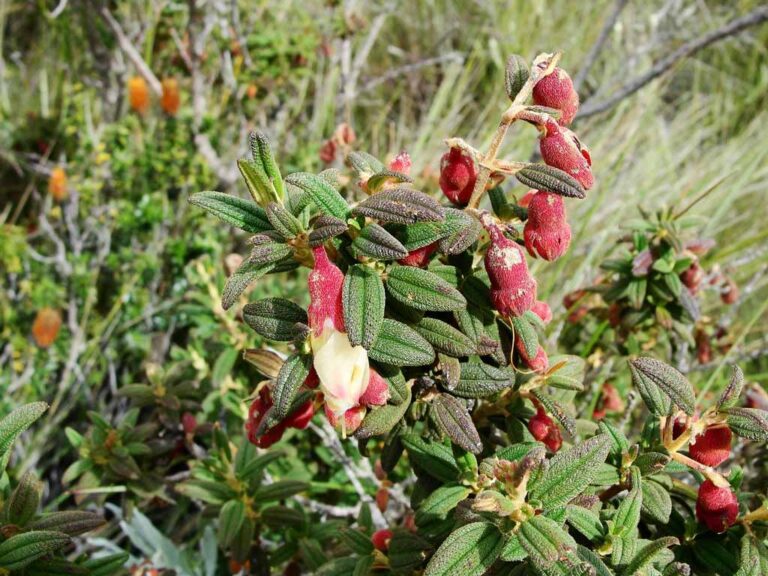
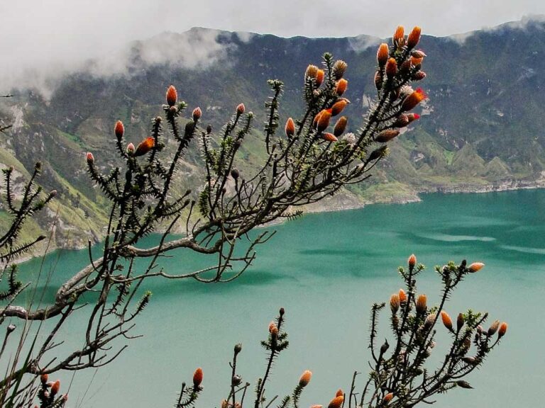
Ilinche - Brachyotum sp.
Chuquiraga sp.
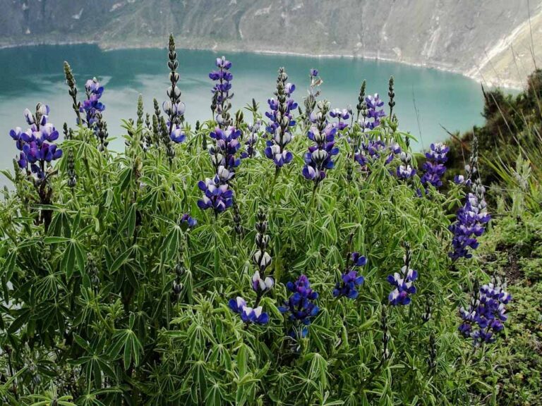
Lupinus sp. - Chocho Silvestre
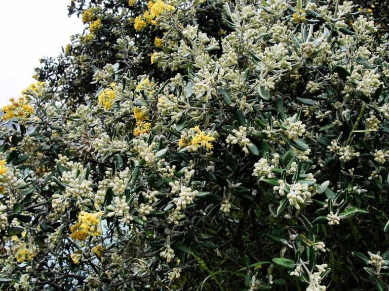
Yagual - Gynoxys Sp
- How to get
- Distances
- Recommendations
How to get
Western Cordillera; 32 kilometers in a straight line west of Latacunga. There are three approach routes to Quilotoa:
- Normal approach “Zumbahua”: From Latacunga take the road Pujilí – Zumbahua (western direction); Alternatively, when going up from the coast, you can take the Quevedo – La Maná – Zumbahua road. Enter the town of Zumbahua and continue along a paved road for approximately 12 additional kilometers to the Mirador del Cráter del Quilotoa viewpoint.
- “Chucchilán” approach: This is a longer approach and requires a hike from the town of Chucchilán to the crater north side. The easiest way to get to Chucchilán is to continue by car from Zumbahua in the direction of the crater viewpoint, almost reaching the viewpoint, you will find a paved detour on the left that goes to the Community of Chucchilán, in total 29 kilometers, an approximate time of 40 minutes.
- “Sigchos” approach: An approach for the most adventurous that also offers beautiful landscapes. This is a tough two-day hike between Sigchos and the Crater Viewpoint on the north side. You could spend the night in the hostels at Chucchilán or in Isinlivi town. This route may require a prior study of the maps and knowledge of navigation with a compass or GPS. It's recommended to obtain more information in Sigchos before starting the hike.
