
Cayambe Map
(Click on the GPS points to see the photos; use two fingers to move the map)
Routes
routes
| Route | Difficulty | Time |
|---|---|---|
| Normal Route | A little difficult (PD) | 8 - 13h |
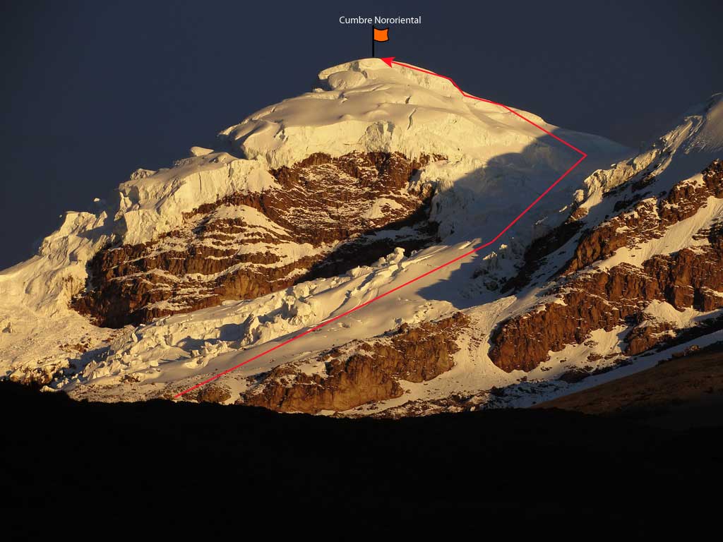
| Northeast Summit Route | A little difficult (PD) | |
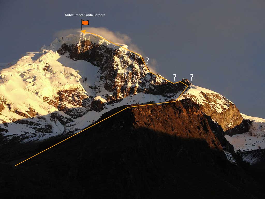
| Santa Barbara Ridge Route | Difficult (D) |
- Recommendations
Recommendations
- Climbers usually leave the refuge towards the Cayambe summit between 23:00 and 24:00. It is customary to climb at night due to the equatorial sun that in the day can strongly hit the slopes loosening the snow and the bridges over the cracks.
- The ascent to Cayambe is usually more technical and demanding than that of Cotopaxi. The Cayambe has a greater propensity to remain cloudy and at times the previous tracks can hardly be distinguished. For this reason, the use of flags is recommended to guide you on your return.
- The route in the upper part has been changing in recent years, sometimes avoiding numerous cracks, which may require a great deal of solvency to reach the top and orient yourself on the way back.
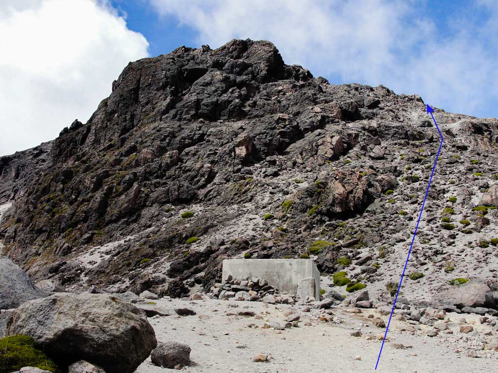
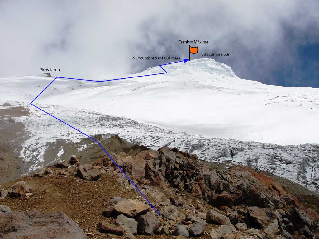
- Leaving the refuge, you may walk directly up the water tanks, this first part is usually sandy and rocky without difficulty. Sometimes it is snowed, which may require a little more caution. It takes about an hour to get to the place where the crampons are fitted. The average glacier slope is between 30 and 40 degrees, it is climbed up directly pointing to "Picos Jarrin". At this point, "Picos Jarrin" is generally passed by its right side.
- Very close to the summit there are huge cracks that in seasons are impossible to cross.
- It is very important to be prepared for any rescue or self-rescue need.
- Likewise, near the summit (by the normal route) there is a ramp of about thirty meters high and more than 50 degrees slope (usually over a crevace); This ramp can demand a more refined technique to climb, and especially to go down, because sometimes it will be covered with ice or powder snow. This area has a greater predisposition to avalanches.
- The current route reaches the sub-summit "Santa Barbara", and from there, it is usually possible to find an easy passage to the Highest Summit.
- The climb is hard, especially the last hour and a half.
- Normally you will reach the summit after six and a half hours of walking and with the first sunrise rays.
- The view of the summit on clear days is spectacular and well worth the effort.
- The return to the refuge takes between three and five hours
- The Cayambe is a beautiful mountain full of mysteries, the ascension will always be a life remembered experience.
- Other routes to the Cayambe summit have been opened sporadically and are only recommended for experienced and well equiped mountaineers.
- Analyzing the mountain from all sides, there are huge cracks and seracs covering its upper section, each day more broken due to global warming, it is possible that a time will come when it won't be possible to find a safe route to the summit.
