
Corazon Volcano Map
(Click on the GPS points to see the photos; use two fingers to move the map)
Routes
routes
| Route | Difficulty | Time |
|---|---|---|
| Aloasí Route | Easy | 6 - 7h |
| Chaupi Route | Easy | 6 - 7h |
- Recommendations
Recommendations
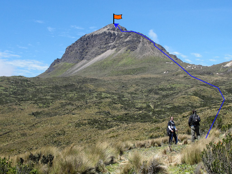
- Route through Aloasí: Starting from the sign, the first section of the hike is very simple, just following the path that zigzags up the mountain (it was once a cart path).
- When the zigzags are finished already at the paramo, the Corazon rocks will be clearly visible, you should take towards the sandy area on the right of the main peak.
- The rock is generally good by any of the two routes to the Highest Summit.
- The Aloasi route has a short climb when it's reaching the summit. Climbing is relatively easy (grade III) and the good rock offers many support points.
- There may be snow on the rocks, especially on winter.
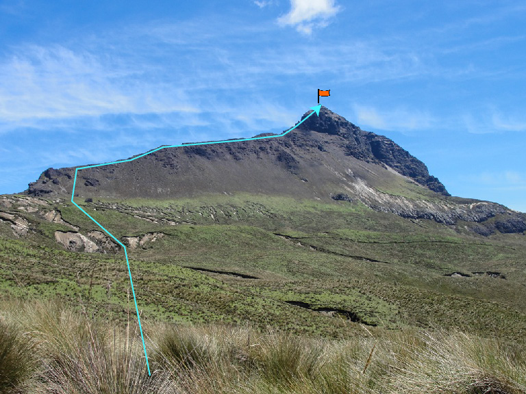
- The Chaupi Route: The hike begins at the entrance control to Illinizas Ecological Reserve.
- Starting from the reserve, follow the vehicle road for approximately 45 minutes until you reach the sign on the right that indicates the detour to the summit of Corazón.
- The trail is pretty clear for the most part, though it can be tricky when it's cloudy.
- This trail begins already at the paramo, following a clear path that crosses a valley until arriving at the south western ridge base.
- The south western ridge is basically a hike until the last section when it's necessary to climb a little on the exposed rock ridge (grade IV at most).
- The descent can be difficult by any of the two routes when it rains or the fog falls.
- The climb to the Central or North summits is very easy, basically hiking. There is another possibility of climbing to El Corazon from Aloag, this very long route requires a car approach and is usually used for climbing all summits.
