
Morurco Map
(Click on the GPS points to see the photos; use two fingers to move the map)
Get Directions
Routes
routes
| Route | Difficulty | Time |
|---|---|---|
| Morurco 360 Trail: | ||
| Parking – South route rock foot | Easy | 2.5 – 3.5h |
| South route rock foot – North route rock foot | Easy | 1.5 – 2.5h |
| North route rock foot – Parking | Easy | 1.5 – 2.5h |
| South Route: | ||
| Parking – South route rock foot | Easy | 2.5 – 3.5h |
| South route rock foot – Morurco Highest Summit | Fairly difficult (AD) | 3 – 4h |
| North Route: | ||
| Parking – North route rock foot | Easy | 3.5 – 4.5h |
| North route rock foot – Morurco Highest Summit | Fairly difficult (AD) | 1.5 – 2h |
- Recommendations
Recommendations
- The vehicular parking, where the hike begins, is 3951 meters high on the south flank of Cotopaxi; the Morurco summit is 4784 meters.
- Starting from this parking you might climb to the southern summit of Cotopaxi, a route that presents similar difficulties to those found on the normal route on the north side. Just above the parking lot you can find the mountain shelter "Cara Sur"; This refuge is suitable for acclimatization before climbing the Cotopaxi.
- Also, starting from this parking lot you can hike to the base of Morurco, which is a rocky peak next to Cotopaxi on the south side.
- If you do not have experience in rock climbing, it is recommended to follow the "Morurco 360" trail. This trail circles the Morurco base offering very attractive landscapes of the glaciers on the Cotopaxi south face and the surrounding mountains and valleys. The trail is not marked and is more visible in some sections than in others; It is not recommended to people without mountain experience and without geography and orientation knowledge.
- You can ascend to the Morurco by the north route or the south route.
- Both routes begin in the paramo, next to the South Face Refuge. Soon, the páramo is transformed into a sandy loin that goes directly to the glaciers on the south face of Cotopaxi.
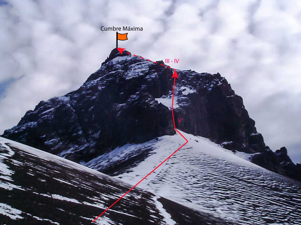
- The south route starts on a barely visible path, which deviates from the ridge to the right and ends at the Morurco valley. This valley has water and is an excellent place for camping. From there you may hike the sand slopes to the foot of the Morurco south face rocks.
- Bypassing a little to the right to find the most obvious point to start climbing. The initial plinth is a wall of good rock about 20 meters, almost vertical, and a V degree difficulty. This wall ends up in a steep sandy slope. The sand is climbed by a rock channel until nearly reaching the summits edge, from there it goes around the eastern side of the rocks, pointing towards the highest summit, climbing by rock of III and IV grade difficulty, very exposed and It may have sections with loose rock. Once this section is overcome, you will reach the summit ridge, and from there easily hiking to reach the highest summit. For the descent, it may be better to mount a pair of rappels.
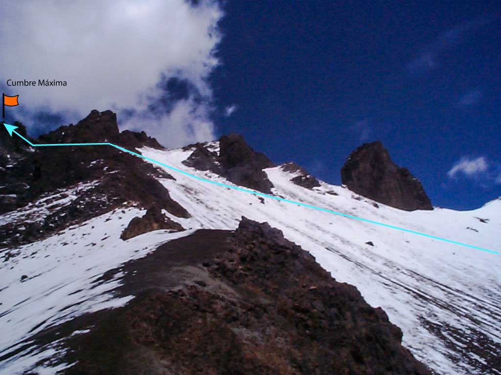
- To get to the northern route it is advised to go up the sandy loin leading to the glaciers on the Cotopaxi south face, over the 4600 meters you should start to circumnavigate the Cotopaxi cone to reach the Morurco north face. The trail is barely visible, so caution is advised, especially if the mountain is cloudy.
- The initial climb is hiking up the sand until reaching the summits edge; then it must be rock climbed, with inclined sections of up to a IV degree difficulty. The rock is not very good and you must be careful with the fall of them. Before reaching the highest summit, it will be necessary to pass through two lower summits.
- The Morurco has usually snow and ice in rainy seasons; that could get nearly impossible the climbing to the summit.
