
Fuya Fuya (Mojanda) Peak
Description
Mojanda is an inactive stratovolcano whose caldera is occupied by three lagoons. Laguna Grande (Caricocha) with 2km of approximate diameter and perimeter of 7km. La Laguna Negra (Huarmicocha) with 600 meters long and 300 meters wide. La Laguna Chiquita (Chiriacu) with 360 meters diameter. Laguna Grande is surrounded by some peaks, among which the most outstanding are the Yanahurco to the East and the Fuya Fuya to the West.
Data Table
| Place | Elevation |
|---|---|
| Summit 1 | 4270m |
| Highest Summit | 4290m |
| Laguna grande | 3730m |
Photos
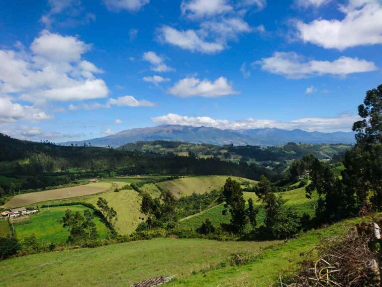
Going to Mojanda
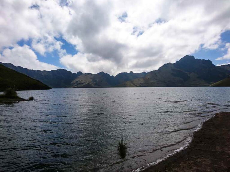
Laguna Grande
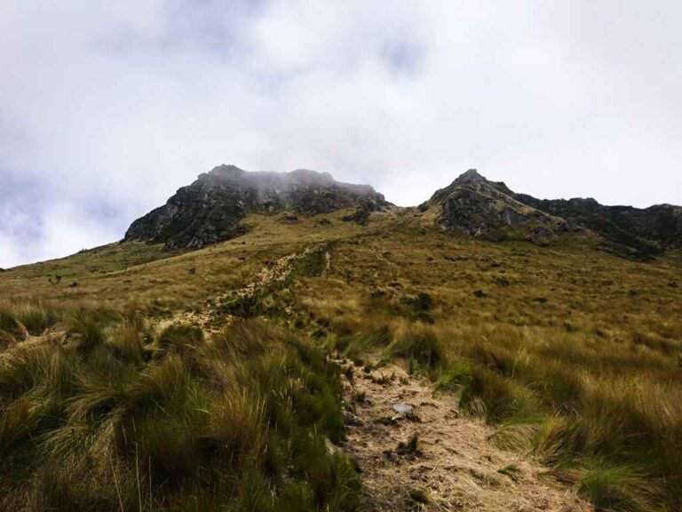
Fuya Fuya peak
Photo Gallery
Climbing and Hiking
- Climb to the summit of the Fuya Fuya peak
- Climb to the summit of the Yanahurco peak
- Around Laguna Grande hiking trail
- Pirámides de Cochasquí to Laguna Chiquita trail
- Malchinguí to Laguna Chiquita trail
- Around Yanahurco hiking trail
- Atahualpa - Laguna Grande trail
- Around Laguna Grande trail, following the summits ridge
- Click for more information
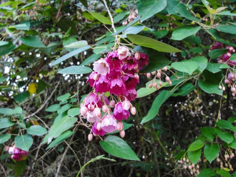
Flora
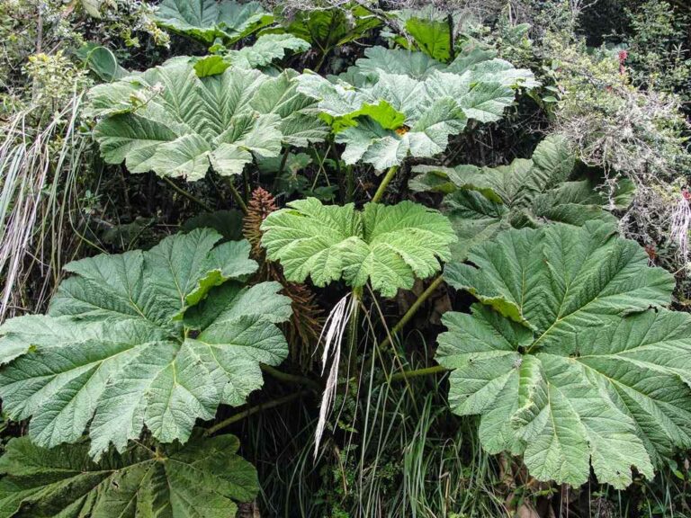
Gunnera pilosa
Vallea stipularis
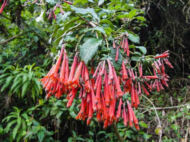
Fuchsia ampliata
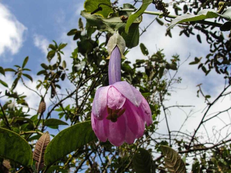
Passiflora cumbalensis
Flora Gallery
- How to get
- Distances
- Recommendations
How to get
Nudo de Mojanda Cajas; 38 kilometers in a straight line northeast of Quito; 11 km southwest of the Otavalo downtown.
- Normal Route Otavalo: Arriving at Otavalo by the Pan-American Hw from Quito, take the road to the left that goes to the "Lagunas de Mojanda". It's necessary to look for a traffic light that allows the crossing to the other lane. The road is stone paved and allows the access for any vehicle until the Laguna Grande. The vehicle is parked as soon as it reaches the lagoon next to a resting roof.
- Atahualpa Route: A longer and rarely visited route. Take the Guayllabamba – Puellaro – San Jose de Minas road. In Perucho you must turn right towards the village of Atahualpa, this town can be reached by any vehicle. Passing Atahualpa the road starts to get bad, depending on the season you could advance more or less 5 kilometers. The hike follows a mule track that eventually reaches the Fuya Fuya peak and later the Laguna Chiquita.
