
Cayambe Volcano
Description
The Cayambe Volcano with its 5790 meters is the third highest mountain in Ecuador. It's completely covered by glaciers from an elevation between 4600 and 5000 meters on the western side, and between 4400 and 4700 on the eastern side; Deeply broken ice masses rising at two main summits from west to east, the Highest Summit and the Northeast Summit; and two “antecumbres” from north to south with the names of Santa Bárbara and Cumbre Sur, in the center of which rises the Cayambe Highest Summit. Its first conqueror was Edward Whymper in 1880. Nowadays it's a mountain crowded by tourists who visit the refuge and the Glaciar Hermoso glacier; a few climbers also venture towards its highest summit, very attractive although less frequented climbed than Cotopaxi.
Data Table
| Place | Elevation |
|---|---|
| Highest Summit | 5790m |
| Northeast Summit | 5570m |
| Ruales Oleas Berge Refuge | 4637m |
| Cayambe | 2840m |
National Park
Photos
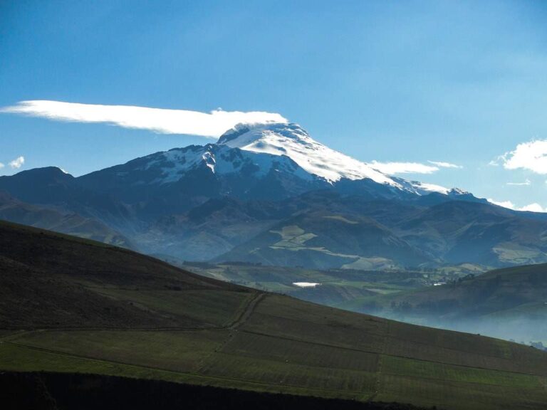
Cayambe Volcano
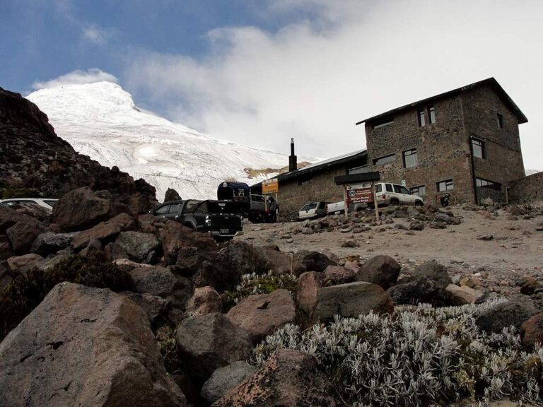
Ruáles Oleas Berge Refuge
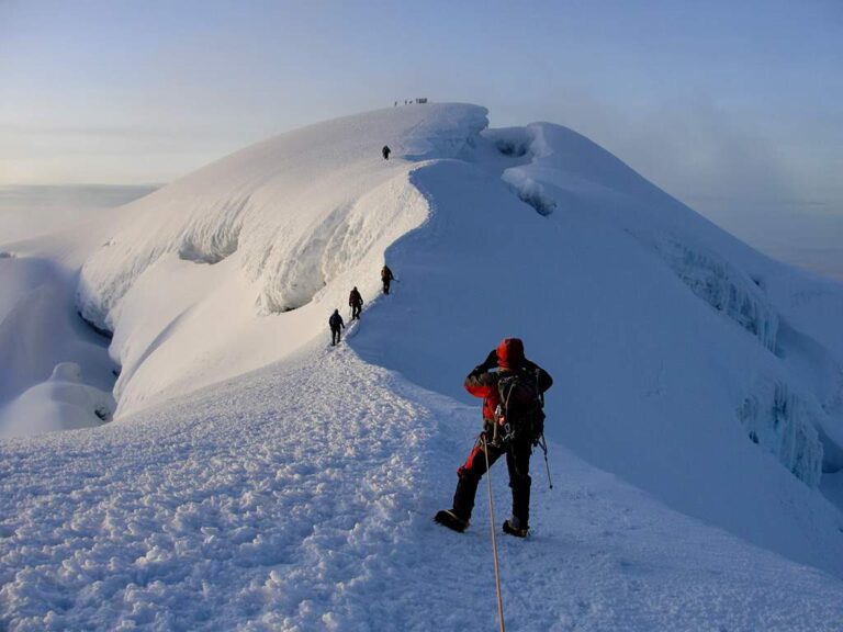
Arriving to the summit
Photo Gallery
Climbing and Hiking
| Private tour | $ 320,00 |
Ruales-Oleas-Bergé Refuge:
- Hike from the “Cascada de los Mirlos” to the Ruales Oleas Berge Refuge. Easy, 40min to 1h (one way).
- Climb to the Cayambe Summit
- Trail from the refuge to “the lagoon”. Medium difficulty, 1 to 1.5h (one way).
- Refuge - “Glaciar Hermoso” glacier Trail. Easy, 15 to 30min (one way).
- Cascada de los Mirlos - “la laguna” ridge trail. Medium difficulty, 1h45 to 2h00 (one way).
- Climbing the Santa Bárbara Ridge to the Cayambe Summit
- Click for more information
San Marcos Lagoon:
- Trekking Antennas - Santa Barbara Ridge Foot. Medium difficulty, 4 to 5h (one way).
Sarayo:
- Approach trek to the Sarahurco Peak
Cycling:
- Olmedo - Laguna de San Marcos
- Piemonte Alto - Sarayo
Flora

Culcitium canescens
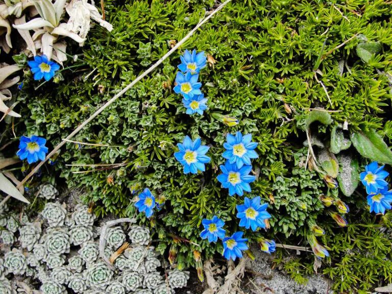
Gentiana sedifolia
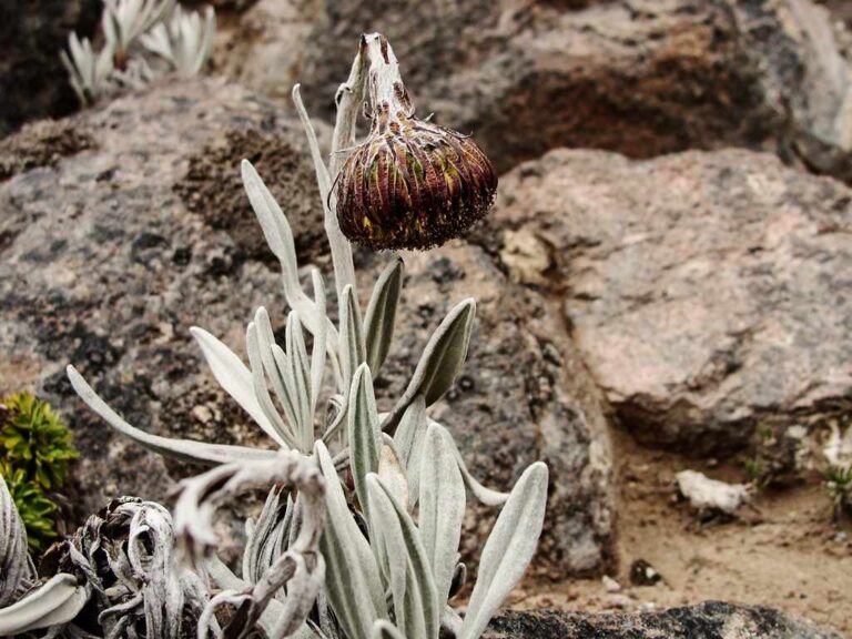
Culcitium nivale
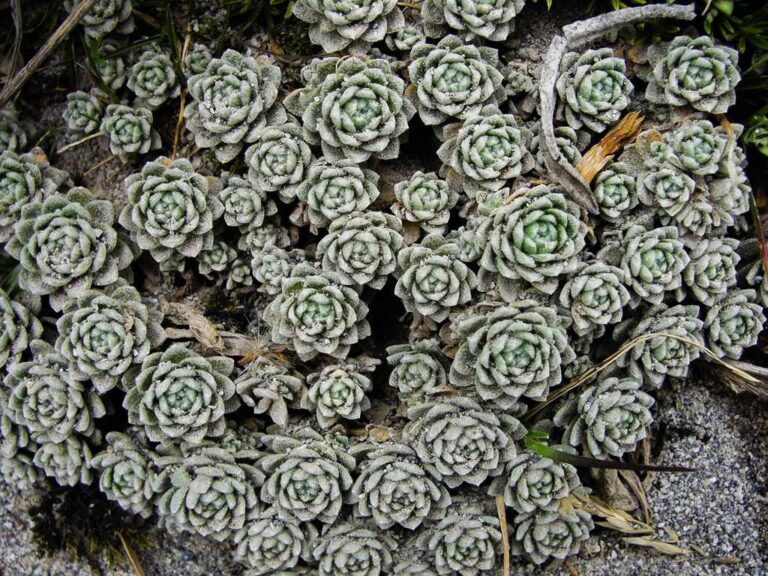
Draba obovata
Flora Gallery
- How to get
- Distances
- Recommendations
- History
- Volcanology
How to get
Eastern Cordillera; 60 kilometers in a straight line northeast of Quito; 17 km east of Cayambe. There are two routes to approach Cayambe Volcano:
- Normal Approach “Route to the Refuge”: Just arriving to Cayambe from Quito there is a first roundabout, on the right starts the Rocafuerte street next to the Yaznan Park, take this street and a little further you will see the sign that shows the road to the Nevado Cayambe. The highway is paved until you reach Cayambe. The road to the refuge is well signposted; mostly cobbled and ballasted, you can go in any vehicle until the Piemonte Alto Community, from there it becomes difficult and only advised for 4×4 vehicles. The last part close to the Ruáles Oleas Bergé Refuge, known as La Cascada de los Mirlos could be very difficult to drive. You could instead park and walk about 30 minutes to the refuge.
- Approach “Laguna de San Marcos” lagoon: About three kilometers following the road from Cayambe to Otavalo, you will find to the right the road that enters the town of Ayora. it's convenient to ask for the road to Olmedo and the Laguna de San Marcos. This road is mostly paved or ballasted, the last part recommended only for 4 × 4 vehicles. This approach is very picturesque although very little used to ascend the Cayambe Volcano.
